dbekaert
dbekaert
Flat terrain and aps in uavsar will show a range ramp mainly because of incidence angle mapping. Even with topography APS will have strong range dependancy. Agreed that beyond the...
This sounds very suspicious. mt_prep scripts should be giving output to both the terminal and in terms of generating PATCH folders with content. Perhaps @mdelgadoblasco has inputs as code-developer for...
@kam3545 can you a test over a small region to verify the mean biass issue has been resolved?
@kam3545 Can we confirm that NCUM product structure identical to the ECMWF model? I understood its model is a modification of the ECMWF model hence; similar variable definitions etc.
Adding optimization label, as the code currently works as is.
@jhkennedy I assume this can be closed if we move part of the text you had in the PR into the README #416 ? I guess the what happens if...
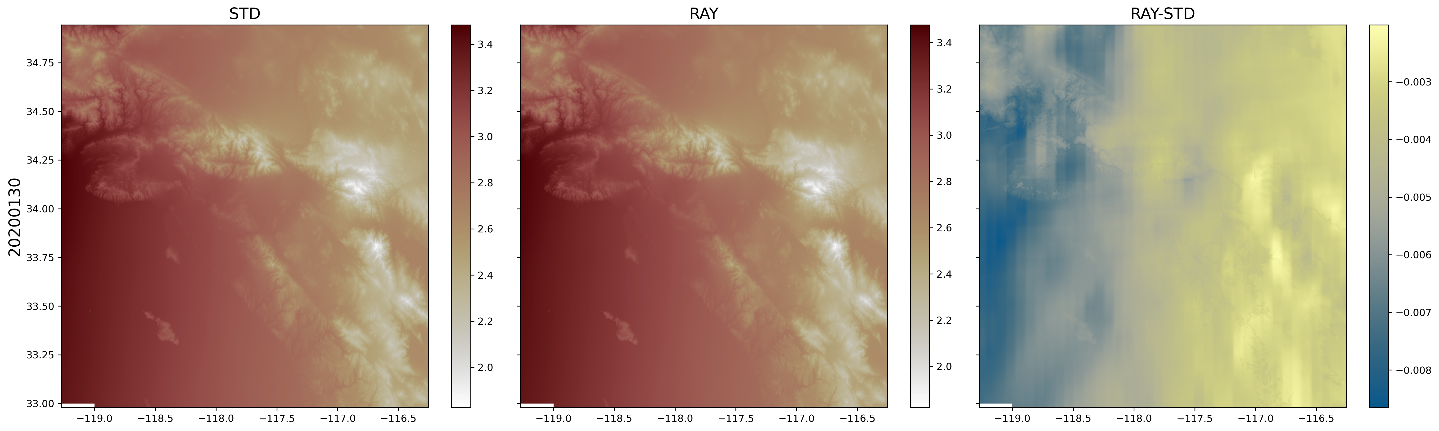
There are a few things to check: - [x] Are both workflows using the same DEM in the code? - [ ] Are we making same assumptions on Geoid and...
But if user specifies the height levels they are interpolated from the 3D cube of the model, where they are hard-coded at fixed steps. So are we missing something in...
yes i understand that part. We should add a larger spatial buffer (long lat bufer). Depending on left or right looking, one side would need more. I was more puzzled...
@bbuzz31 @jlmaurer have we close the loop on the buffering to remove the tilt like residual? >