Stefan
Stefan
@tproduit Results for nodes in Mike+: 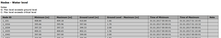  For backflow_level
@tproduit Results for weirs etc. in Mike+: 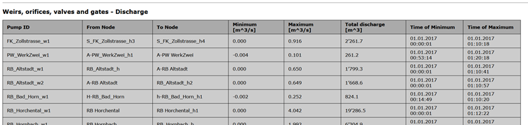  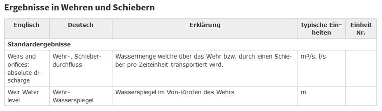
SWMM results (chapter 9.2 Viewing Summary Results ) [User Manual](https://www.epa.gov/water-research/storm-water-management-model-swmm-version-51-users-manual) 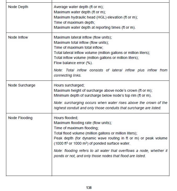 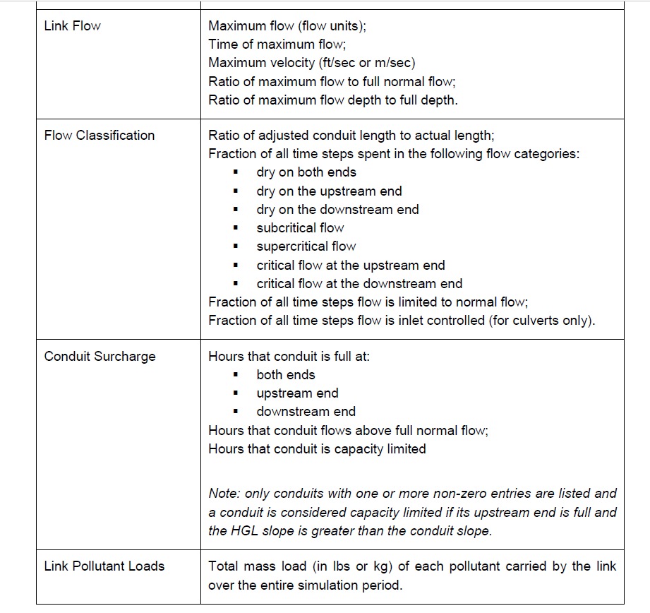
@ponceta @urskaufmann Did you write a short documentation already on how to split a reach with the current QGIS tools already? Here I did not find any details: https://qgep.github.io/docs/user-guide/editing/editing.html#split-a-reach-channel-into-different-reaches
@bogdanvaduva Thanks. Does it also add a wastewater_node inbetween the two new reaches?
@bogdanvaduva Thanks for clarification and the example.
@bogdanvaduva Any hint why I get this Error: ERROR: FEHLER: Syntaxfehler bei »(« LINE 68: ...th(ST_EndPoint(v_geom3d),ST_StartPoint(v_geom3d)))(ST_Distan... ^
@bogdanvaduva same Error in LINE 70
Great - the function works now:  What I do not know is where it splits the reach exactly - in the middle? 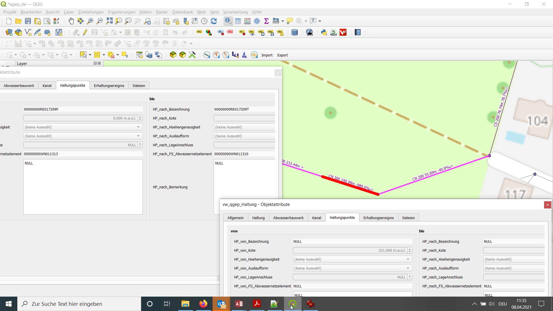 And it looks like the foreignkeys...
@bogdanvaduva So if I understand you right` v_point character varying DEFAULT ''::character varying` would need to be the identifier of an existing wastewater_node to be the locations, where the reach...