RoadDetections
 RoadDetections copied to clipboard
Road detections from Microsoft Maps aerial imagery

Nice work! Would you be kind enough to share the codes for Geometry Generation? I will only use it for academy purpose. Thanks in advance.
Its not a valid geojson file so i cannot open it any GIS software. Any simpler way to convert downloaded tsv file into valid geojson file ?
Any chance that the approach used here could generate estimates of additional attributes for road segments? I'm particularly interested in road widths as a starter, important for priortising locations for...
Hello, There's a large number of invalid linestrings in the `_USA.tsv` file that only contain a single point or are self-referencing. **Only about 88% of the rows in the US...
A lot of roads on the Latvian side of the border with Estonia are marked as Estonian. 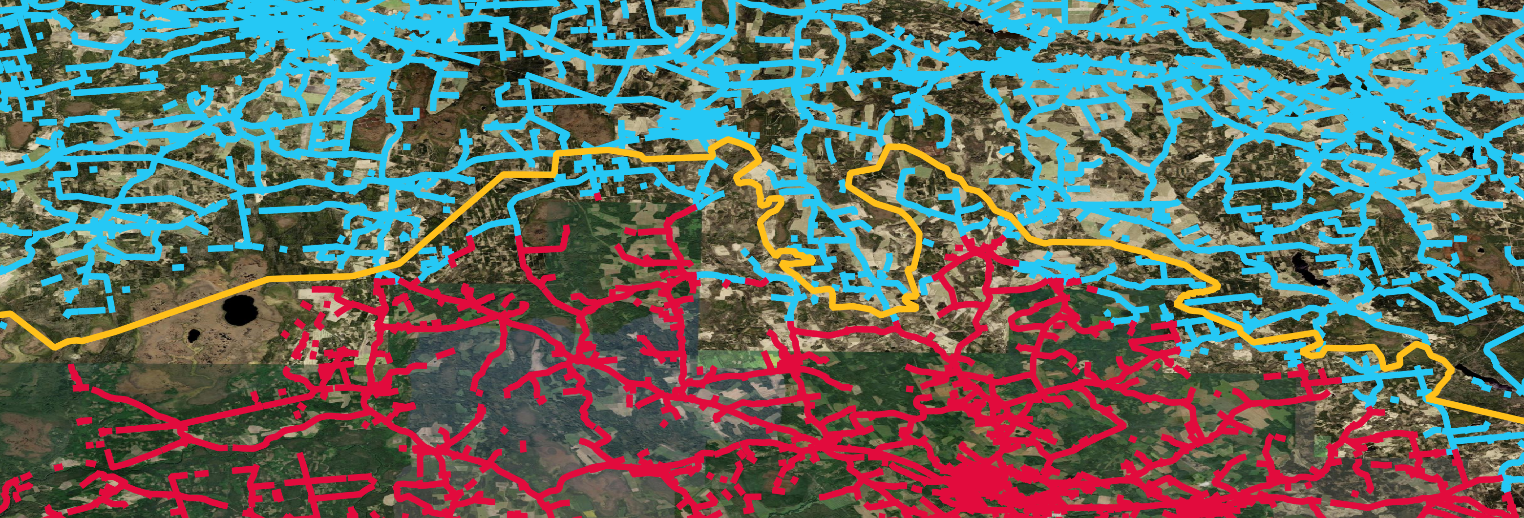 Most of Monaco's roads are marked as French. A very small part...
The USA data [here](https://usaminedroads.blob.core.windows.net/road-detections/USA.zip) has the following issue: - Unlike all other regions' data, of the 54,484,737 **GeoJSON** entries in the USA data 204,789 are invalid as they consist of...
``Oceania-Full.zip`` is 282 MB at the moment. If its GeoJSON file was partitioned by country and sorted the ZIP file would be 244 MB instead. This would allow people to...