mapshaper
 mapshaper copied to clipboard
Tools for editing Shapefile, GeoJSON, TopoJSON and CSV files

I may be misunderstanding something, but if I set the stroke-width with e.g. style stroke-width=0.5 and then save the shapefile, the dbf file truncates stroke-width to stroke-wid (only 10 characters...
It is a feature request, considering the unique topological decomposition process which is at the center of mapshaper. Such as the `this.partCount` property, would it be possible to add (after...
it looks like -mosaic, applied to a dissolved layer, takes into account the initial layer Here is a reprex: https://mapshaper.org/?files=https://gisco-services.ec.europa.eu/distribution/v2/nuts/geojson/NUTS_RG_60M_2016_3857_LEVL_1.geojson `-mosaic -info` => 211 records https://mapshaper.org/?files=https://gisco-services.ec.europa.eu/distribution/v2/nuts/geojson/NUTS_RG_60M_2016_3857_LEVL_1.geojson `-dissolve CNTR_CODE + name=cntr...
it looks to me than there is missing end-of-line for the last record for at least in TSV output file - there is just end-of-file but no end-of-line for the...
I have loaded 2 shapefiles and, willing to add a third one, i can't, clicking the Add file button does not yield anything: 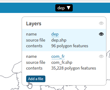
**Output .prj always contains the same wkt projection string** This command: ``` mapshaper.cmd -i cal-3-features-simplified.json -o output/export.* format=shapefile encoding=utf-8 ``` Results in this .prj file: ``` GEOGCS["WGS84",DATUM["WGS_1984",SPHEROID["WGS 84",6378137,298.257223563]],PRIMEM["Greenwich",0],UNIT["degree",0.017453292519943295]] ``` Even...
Consider adding support to mapshaper-gui for all the -i command options. Among other benefits, this could improve the output of the web console's "history" command, which converts a web UI...
The -info command and the GUI bbox info display should display both the projected and lat-long bounding boxes of projected layers
Mapshaper removes all keys which are not type / features from a FeatureCollection object. [GeoJSON spec states](https://tools.ietf.org/html/rfc7946#section-6.1) that foreign members / keys are allowed on GeoJSON objects. I guess it...
I am attempting to export a map to SVG with labels as text, but I cannot get it to work and the documentation for this feature is difficult to find....