mapshaper
 mapshaper copied to clipboard
Tools for editing Shapefile, GeoJSON, TopoJSON and CSV files

Is it possible to fill in small gaps between two different polygons? I've come across this [Command to remove splinter polygons](https://github.com/mbloch/mapshaper/issues/88), but couldn't tell from the comments whether this was...
Hi, I would like to use [b_s.zip](https://github.com/mbloch/mapshaper/files/5719787/b_s.zip) to erase part of [a.zip](https://github.com/mbloch/mapshaper/files/5719785/a.zip). To do it I run ``` mapshaper a.shp -erase b_s.shp -o output.shp ``` But I have that `b_s.shp`...
Hi, is it possible to split a stack of polygons (inside a single layer/file) using a line as a knife? Thank you 
Hi. I'm trying to convert shp file to csv file that contains geometry field like this. ``` WKT,ID,KEY,CODE "MULTIPOLYGON (((127.290556943059 36.5842519794696,127.290611651239 36.5842024296174,127.290634402937 36.584141632486,127.29054876164 36.5841119839701,127.290432586414 36.5841102065694,127.290301253465 36.5841517058113,127.290443485747 36.5842944650442,127.290556943059 36.5842519794696)))","1","202012","36" ``` When...
I'm usually never stuck by any of the great features of mapshaper but this time... I have a polylines geojson with some polylines who cross the 180th meridian. When I...
The doc states: > "When working with multiple polygon and polyline layers, the -simplify command is applied to all of the layers." But why is that? It can prove useful...
Here is a simplified use case: 2 layers, i simplify and filter the first one, then merge both. And i get a bunch of red dots, many line intersections are...
I select a polygon in a layer (via Select features) then click the Split button. I am getting 2 layers named '1' and '2'  But it is not consistent...
allowing for instance to create, after clipping with it another layer, something like this: 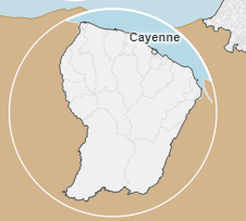
I love the possibility to call mapshaper.org with the `file` parameter, allowing for instance: https://mapshaper.org/?files=https://.../mylayer.geojson;https://.../mydata.csv Would it be possible to add a script file, containing mapshaper command to run after...