dieterdreist
dieterdreist
I just found land polygons disappearing here (zooming in):    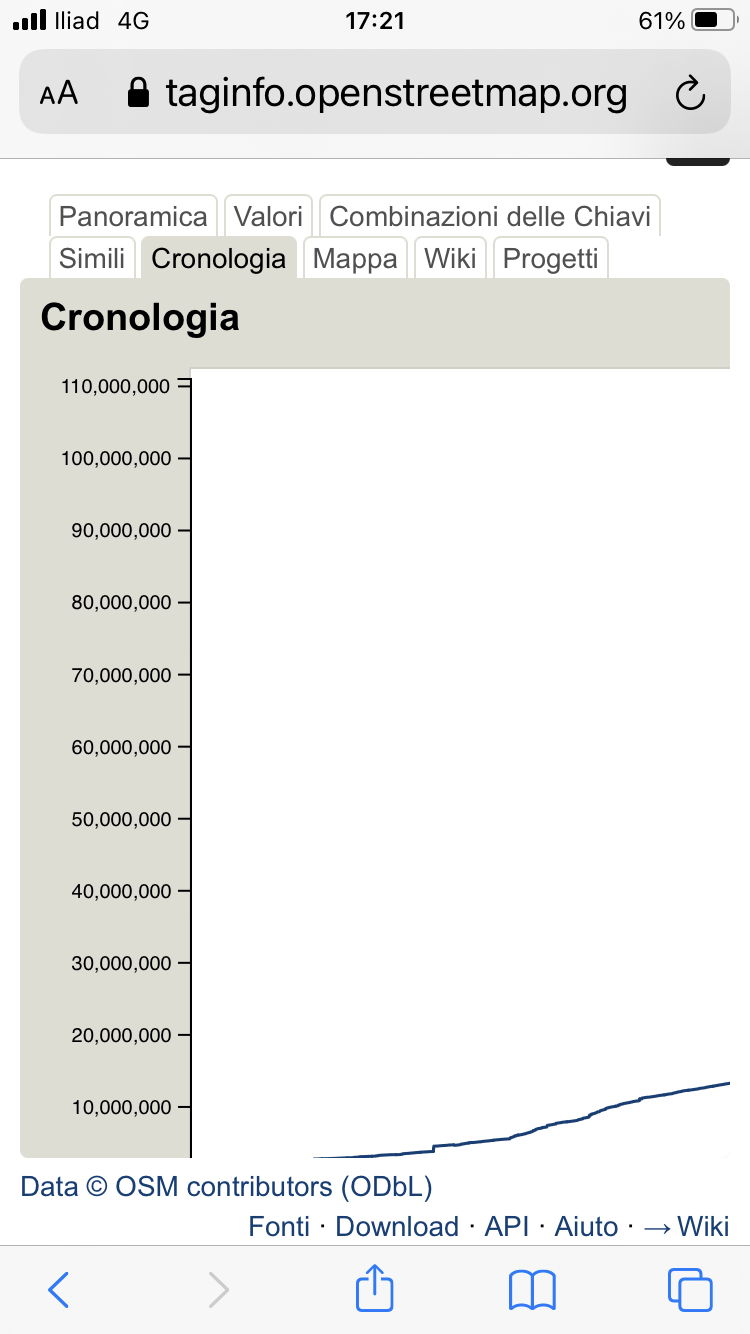
I managed to get some zoom working by reducing the font size. Changing from portrait to landscape and back then shows the x-axis, but the graph is still cut on...
a quick and dirty workaround to make the whole graph width accessible can be achieved with this css (it doesn't work for the height though): ``` #chart-chronology { overflow-x: auto;...
I confirm this is still an issue. Using these versions like described [here](https://lists.openstreetmap.org/pipermail/taginfo-dev/2015-May/000231.html) solved it for me: sudo gem install rack -v 1.4.5 sudo gem install r18n-core -v 1.1.11 sudo...
from my understanding, subject:wikidata would be about the people who are commemorated on the stones, most of which are not famous and there is neither a wikidata nor a wikipedia...
sent from a phone > On 28. Jul 2019, at 07:04, Charlie Fish wrote: > > OpenStreetMap should adopt this new standard and allow for dark mode on the website....
this is quite interesting. It is rendered differently on different engines though. This is on mac, Firefox and on Safari:  