Dave
![]()
![]()
![]()
Dave
This is designed to be a general coordinate-flattener, where it can handle any level of nesting of matrices and lists. ```r l
not for me; still getting the crash
yes: > -[MTLDebugRenderCommandEncoder validateCommonDrawErrors:instanceCount:baseInstance:maxVertexID:]:5200: failed assertion `Draw Errors Validation vertex_id type is not big enough to draw this many vertices (4294967295) 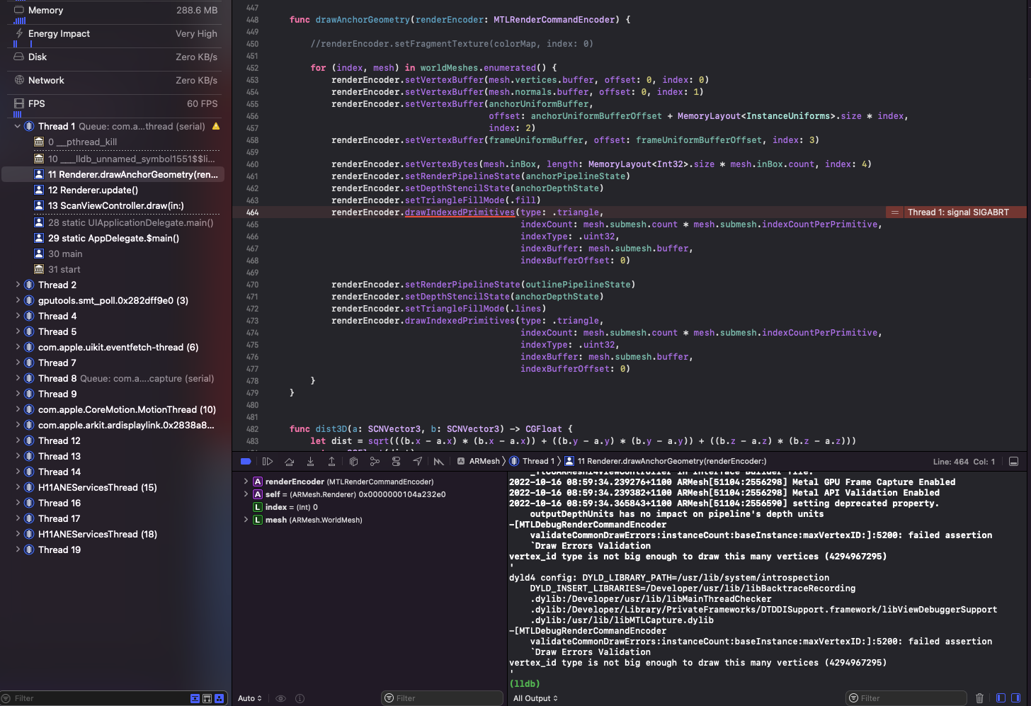
Incidentially, `4294967295` is the maximum `UInt32` size So possibly `vertex VertexOut anchorGeometryVertexTransform()` should have `uint vid` rather than `ushort vid`?
This is not currently possible. I keep intending to look into this but just don't have the time. If you know of a solution I'll happily accept a PR
@kmcd39 you don't need the `jsonlite::read_json()` step, the `style` argument will accept the URL as input: ```r mapdeck::mapdeck( style = style.pth ,location = c(-73.9165, 40.7514) ,zoom = 10 ) ```
Hi @Robinlovelace - thanks for the question. Yes, absolutely there are plans, but nothing concrete or well-formed yet. Kyle also developed lonboard - https://twitter.com/kylebarron2/status/1716854794994823646 - which uses geoarrow & deckgl....
Thanks @jaredlander , very useful to know.
> Mapbox layer of just streets and labels on top of the polygons. Do you mean that this 'layer' will only cover the area of the map that also contains...
Not directly addressing your misalignment issue, however, I've just updated all the cesium loaders, and updated the `?add_cesium()` example with the (now) correct URL. The buildings and the pointcloud now...