Brian Sperlongano
Brian Sperlongano
The artifact is actually present in the Mexican example you posted. Since that style renders road labels down the middle of the ways rather than alongside them, the artifact is...
Issue demonstrated on repeated `wget` requests: 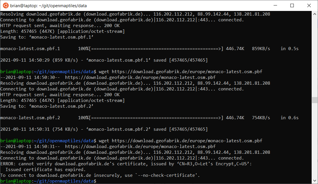
@nyurik @TomPohys, would it be acceptable to switch https to http for the geofabrik download? That should solve any certificate issues.
Google says `--tries=X` can be passed to wget.
Looks like wget is not what we use, but rather python if I'm reading this correctly: https://github.com/openmaptiles/openmaptiles-tools/blob/3b2a0675294d2db35ce432f51a0cdddf9ea6b073/bin/download-osm#L368-L372
Thanks for bringing this up! Parks and protected areas is something I think about a lot in OSM. I would oppose using `protect_class` for any sort of primary class logic....
Usually this occurs when the bounding polygon used by geofabrik extracts clips part of the boundary. You should email [email protected] to get this corrected on their side.
Thanks for the analysis, we'll need to dig deeper.
It appears that the issue is that there are several islands in the [Taiwan boundary relation](https://www.openstreetmap.org/relation/449220) that are well outside the data file clipping area: 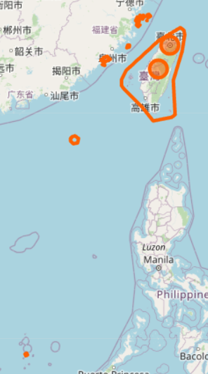 Unfortunately, imposm will drop...