wradlib
 wradlib copied to clipboard
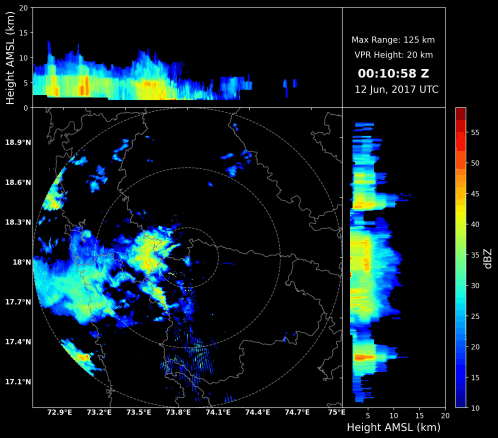
Need to improve Max-Z (CAPPI) plots, Also if you could make it compatible with cartopy as well as raster files (DEM, SHP)
Example;
I want to request you to add some more features to the CAPPI plots to add text, more particularly date and time from the dataset itself as well its compatibility with cartopy and raster files.

@syedhamidali Thanks for opening this issue.
We would need to completely free wradlib from any oldstyle pylab style plotting. So if anyone wants to take the lead here...
I have improved it according to my need, I would like share code and result, it looks good.
@syedhamidali Yes, please go ahead. This will be a great improvement in wradlib compared to the current solution.
Any interested in the code can check out https://github.com/syedhamidali/CAPPI-NETCDF/blob/main/MaxZ%20(1).ipynb
While researching #545 this resurfaced. The plot_plan_and_vert and plot_max_plan_and_vert need to be properly refactored/reimplemented.
Plotting functions have been revisited. Additional plot-items could be added afterwards.