[quest] End of the road?
General
Affected tag(s) to be modified/added: Very last node node at the end of a highway=*
Question asked: What is at this end of this road?
-
"a turning loop with a non-traversable island" : highway=turning_circle
-
"nothing, dead end" : noexit=yes
-
"a turning circle" : highway=turning_circle
-
"this is not the end of the road, it continues..."
- So you see the continueing road on the map?
- yes : bug=Nodes are close to each other but not connected
- No : fixme=continue
-
"the road ends but there is a footpath..." : note=path ist missing
Checklist
Checklist for quest suggestions (see guidelines):
- [x] 🚧 To be added tag is established and has a useful purpose
- [x] 🤔 Any answer the user can give must have an equivalent tagging (Quest should not reappear to other users when solved by one)
- [x] 🐿️ Easily answerable by everyone from the outside but a survey is necessary
- [x] 💤 Not an overwhelming percentage of quests have the same answer (No spam)
- [x] 🕓 Applies to a reasonable number of map data (Worth the effort)
Ideas for implementation
Element selection:
Find the begin and end node of a way with the key highway=*. This nodes need to be connected to another way or should have noexit=yes or should have fixme=continue .
Thinking about edge cases like when a pathway leads into a park, it probably would trigger this but neither tag would make sense. You'd want to exclude paths that end inside areas like amenity=park, natural=beach
Another thing, particularly with paths and other less important highways is that the path might gradually fade out into an area where people walk as they like, particularly in parks or beaches, as mentioned by @andrewharvey. However, parks, at least, are also likely (or as likely as anywhere else) to contain paths that need continuing.
It also shouldn't be asked for highways whose final node is on a building way.
Not sure about barrier nodes. If it is a gate, it will continue in some way the vast majority of the time. For farmers' fields, it might not really continue as any path/track worth mapping, though. With some other barriers, it might stop there. It may still be worth asking in these cases.
should skip roads which end with a
highway=turning_circle.
What if there is a footpath that continues that hasn't already been mapped? We would want to find that.
What if there is a footpath that continues that hasn't already been mapped? We would want to find that.
There is much lower chance of that and such tagging is going to be less likely to be welcome.
Overall I am still unsure about this quest, but aggressive filtering any dubious cases is likely preferable.
Hmm, it would be wrong to add noexit=yes where there is a turning circle in reality, right? Same with turning loops... and maybe other things(?).
So, the quest would need to ask something like "What is at this end of this road?" and the user can answer "nothing, dead end", "a turning loop", "a turning circle", "this is not the end of the road, it continues...", "the road ends but there is a footpath..." and/or more.
Hmm, it would be wrong to add
noexit=yeswhere there is a turning circle in reality, right? Same with turning loops... and maybe other things(?).So, the quest would need to ask something like "What is at this end of this road?" and the user can answer "nothing, dead end", "a turning loop", "a turning circle", "this is not the end of the road, it continues...", "the road ends but there is a footpath..." and/or more.
OK, i didn't know thus turning nodes. I will rewrite fhe proposal!
Still, I am kind of "😬" about this, I fear we might miss something. I think what should be done first is some research (with an overpassquery ) to find such situations and Stichprobenartig see what situations can in reality exist.
I think we will find many unconnected footways ending before a house like
https://www.openstreetmap.org/way/220513514

What is the argument against the noexit=yes tag here? The tag would at least explicitly define the end of the path.
Hmm, it would be wrong to add
noexit=yeswhere there is a turning circle in reality, right? Same with turning loops... and maybe other things(?).
I don't think it would be wrong. Ways can still continue after turning circles, either as a lesser highway, or even the same type.
I've looked up some turning circles.
- https://www.openstreetmap.org/node/826166797: This is a turning circle at the end of a road, with no other paths mapped. From aerial imagery, I suspect there may be a footpath (or two, it's more of a T than a circle) that connect(s) with the main(er) road. If I was there, I would want to be able to tag either
noexit=yesorfixme=continue. - https://www.openstreetmap.org/node/6847503010: Already has a path mapped, but if it hadn't it might be the same as the above.
- https://www.openstreetmap.org/node/828943779: This node is definitely a turning circle with no exit, which we would want to tag
noexit=yes.
So, the quest would need to ask something like "What is at this end of this road?" and the user can answer "nothing, dead end", "a turning loop", "a turning circle", "this is not the end of the road, it continues...", "the road ends but there is a footpath..." and/or more.
General
Affected tag(s) to be modified/added: Very last node node at the end of a highway=*
Question asked: What is at this end of this road?
* "a turning loop with a non-traversable island" : [highway=turning_circle](https://wiki.openstreetmap.org/wiki/Tag:highway%3Dturning_loop)

* "nothing, dead end" : [noexit=yes](https://wiki.openstreetmap.org/wiki/Key:noexit)

* "a turning circle" : [highway=turning_circle](https://wiki.openstreetmap.org/wiki/Tag:highway%3Dturning_loop)

* "this is not the end of the road, it continues..."

  * So you see the continueing road on the map?
  * yes : bug=Nodes are close to each other but not connected
Would that be better as a fixme? Close ways are often detected by QA tools anyway, but we'd need to have a tagging for that situation.
* "the road ends but there is a footpath..." : note=path ist missing
Wouldn't fixme=path is missing or fixme=continues as path or fixme=continues as another highway type be better?
I don't think it would be wrong.
I am not exactly worrying that it would strictly invalid. I rather worry that it would be pointless/unwanted/disliked/irritating/unwelcome.
@HolgerJeromin , I think there is a misunderstanding. I think this quest is supposed to be asked for endpoints of roads, not of paths. Also, when a turning circle is present, the quest should not be asked.
I think this quest is supposed to be asked for endpoints of roads, not of paths.
Fine with me, but we should adjust the description of the issue in that case:
Very last node node at the end of a highway=*
and
Element selection: Find the begin and end node of a way with the key
highway=*.
Stichprobenartig
Random/randomly (which wasn't part of my schoolboy German!)
Perhaps two things have been mixed up here that should be treated separately?
- The discussion is about "paths in the woods". That means "non-urban" (while urban is the area where the current proposal would trigger a lot of useless tasks and/or floods of unnecessary noexit=yes)
- In the above suggestion, the default answers provided include "turning_loop" and "turning_circle" which make no sense for paths.
I personally don't like the combination of "prominent default answer results in fixme" and "average user doesn’t know much about what his answer actually does" and "many of those fixme will only be able to be fixed on the ground" and "many of these continuing path/roads are not mapped for some reason, for example private property". This could easily lead to a huge mass of fixme that will never be worked on, but which prevents the few active local editor mappers from even looking at fixme tags.
Please provide an Overpass query for this proposal. Then we could probably drastically reduce the amount of useless tasks.
In urban areas we should completely skip
- highway=footway|path (1)
If the end node is within amenity=parking we should skip
- highway=service (2)
Of the remaining highways we should skip any way with
- man_made=pier (otherwise 100% noexit which is useless)
Of the remaining end nodes we should skip any with
- highway=turning_circle (as mentioned above)
- highway=turning_loop (as mentioned above)
- noexit=yes (as mentioned above)
- fixme= (any value! Do not replace a "fixme=Here are steps leading south and upwards" with "fixme=continue"!)
- leisure=slipway (no need for noexit)
- amenity=parking_entrance (don't enforce micro mapping of underground parking)
- entrance= (any value, don't enforce indoor mapping)
- barrier= (for example barrier=gate seems to be common practice to state "here begins private property which is not mapped since there is no benefit of mapping it")
Summary: Usecase A “pathes in the woods”: Please think again about guidelines “Effort vs impact”, “Easy answer”, “Publicly accessible” and “Valuable Surveyors” as these end nodes are rarely turning_loops, likely to fade out (impossible to map better and not noexit=yes), may continue but might already be tagged with a some fixme, can easily be spotted on maps already and most important: to fix this one has to visit the location on the ground again, and follow/track the path. Regarding "No spam" I'd guess that most of those ways would end up with a fixme= which is no improvement.
Usecase B “missing turning loops”: Let’s assume we limit the quest to “highway=(living_street|pedestrian|residential)” and skip the end nodes mentioned above. Even then I’ve got a feeling that this quest might create far more problems than is solves. What to answer if there is a (missing) turning_loop, and a missing path? And what should the average user answer when the path is more or less clearly private? What should he answer if there is no loop, but a private driveway? Please think again about guidelines “Users are no experts” and “Easy answer”.
Footnotes: (1) skip highway=footway|path in urban areas, because of many cases like @HolgerJeromin mentioned in https://github.com/streetcomplete/StreetComplete/issues/3705#issuecomment-1028267285. Might otherwise demotivate mappers by enforcing a level of micromapping they did not want to do, while having hardly any advantages. noexit=yes obviously wrong, but fixme= will never get solved. Similar cases mentioned by @andrewharvey in https://github.com/streetcomplete/StreetComplete/issues/3705#issuecomment-1026327588 with the list of areas to be excluded could be continued. Have a look at cemeteries for example. Urban area in this context does include(!) smaller landuse=wood, gras and so on because people tend to map an area when some trees stand together...
(2) highway=service without service= correctly tags the way accessing the parking area. In case there are no additional "highway=service + service=parking_aisle" mapped,(which is common for smaller parking areas) the end node has correctly no tag.
That could probably be simplified as "if the ending node of the way has any tag at all, skip this quest"
As for the other suggestions, tags on the way (like man_made=pier) are probably cheap, but detecting if way is inside parking might be more expensive. Not to mention detecting if the way is "inside urban area" (we don't have that detection even in existing quests like speed limit quest, instead resorting to asking user explicitly)
I looked at it again and I must say that I quite like this idea.
I will probably implement it either way for myself at least (though I would likely not add fixme tags, just switch to Vespucci)
I am not exactly worrying that it would strictly invalid. I rather worry that it would be pointless/unwanted/disliked/irritating/unwelcome.
I am still worrying about how it would be liked/disliked by wider community. Especially as it would be the first quest adding fixme tags. What you think about asking on some wider forum such as https://community.openstreetmap.org/ and/or mailing list and maybe also proprietary discussion locations such as Discord/Slack?
(I could ask, but of someone else would ask what people think about SC adding fixme tags on a large scale)
Sure, feel free to start. I realize with the discussions that the quest will go over my head as a newbie anyway and I'm happy about your expertise and help.
@matkoniecz could you outline what is your plan on implementing it? Can you summarize how you will tackle the issues mentioned in this thread? (P.S: I don't like the notion of StreetComplete adding fixme somewhere. Would your plan still work without it?)
Would your plan still work without it?
no
it fundamentally relies on it as one of answers
"this is not the end of the road, it continues..." No : fixme=continue
and is my primary reason why I am unsure is it a good idea (though for me it is worry about reaction from community and whether it will be liked by others, for me that would be a good idea and helpful)
I don't like the notion of StreetComplete adding fixme somewhere
I guess that it can be WONTFIXed given this (if that is not actually instantly failing this quest - please reopen)
I don't like it but if the broader community has no issue with it, then this is okay.
@matkoniecz could you outline what is your plan on implementing it? Can you summarize how you will tackle the issues mentioned in this thread?
Primary tricky cases:
This could result in SC mappers adding thousands, tens of thousands fixme=continue
Some people at least will grumble, maybe many of them.
Solution: ask people first and either WONTFIX this or in case of complaining after release: link discussions
(there is still risk of substantial complaints only after release or long-term complaints)
For roads:
primary problem is cases where road ends and continues as driveways. Basically, case like here where driveway is not yet mapped
in such case spamming fixme=continue would be appreciated only in places already deeply micromapped.
Solution: skip highway=residential highway=service
For footways, where my plan is to basically "lets not implement it for footways":
Thinking about edge cases like when a pathway leads into a park, it probably would trigger this but neither tag would make sense. You'd want to exclude paths that end inside areas like amenity=park, natural=beach
a) if leisure=park area is very big SC could miss it (all elements for download outside bounding box used for download)
b) it may kill performance to run such checks
That is a primary issue where I have no convincing answer right now, I likely would look into a better tagging for such case.
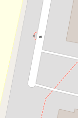
I think we will find many unconnected footways ending before a house like https://www.openstreetmap.org/way/220513514
in such case path terminates nearby, but correct answer would be fixme=continue
Part of potential problem is that StreetComplete would be basically adding fixme=please micromap this area
unknowns: as mentioned this may run into problems that were not initially predicted.
no residentials
I think this does not solve the issue you try to avoid and also takes away most of the usefulness of this quest:
Where to expect turning circles in non-residential areas? -> Commercial/Industrial districts, where the roads are often tagged as highway=unclassified. There, you'll also have the situation that at the end of the road, the road continues into the industrial landuse. I think, any place that potentially has a turning circle also has potentially abutters.
no footways
Ok. Wouldn't make sense otherwise
fixme:continue
I agree that if you bring it up on the appropriate channels and they are OK with it, then fixme:continue is no problem.
It is truly a shame that noexit=yes means there is no exit whatsoever, for any mode of transportation. If there was a tag to mean "the road ends here", this could be set in cases where a footway or driveway "continues".
Anyway, I will close this. It seems the subject is far more complicated/problematic to handle than initially assumed. And TBH, whether there is a turning circle somewhere can also usually be seen from aerial imagery.