Azimuth vs Elevation vs Multipath plot?
I've just started playing with this package and it is great, but quite overwhelming in the amount of information it provides. I am mainly trying to track down possible improvements in my current (very bad) antenna location and the individual plots are too fine grained for my issues.
I have thought that azimuth vs elevation vs multipath (and a similar plot for CNo) would be nice summary tools to evaluate multipath sources and signal obstructions. Put azimuth on the X axis and elevation on the Y axis, and use color to indicate multipath or CNo for the mean of all constellations and signals. This would allow you to see the source of reflections as well as sky obstructions.
Would you consider adding something like this?
Thanks for your work on this software!
John
Thank you for reaching out! I'm glad to hear you're exploring the software.
The current version includes polar plots of SNR and multipath as functions of azimuth and elevation (see examples below), but these visualize individual satellite estimates:
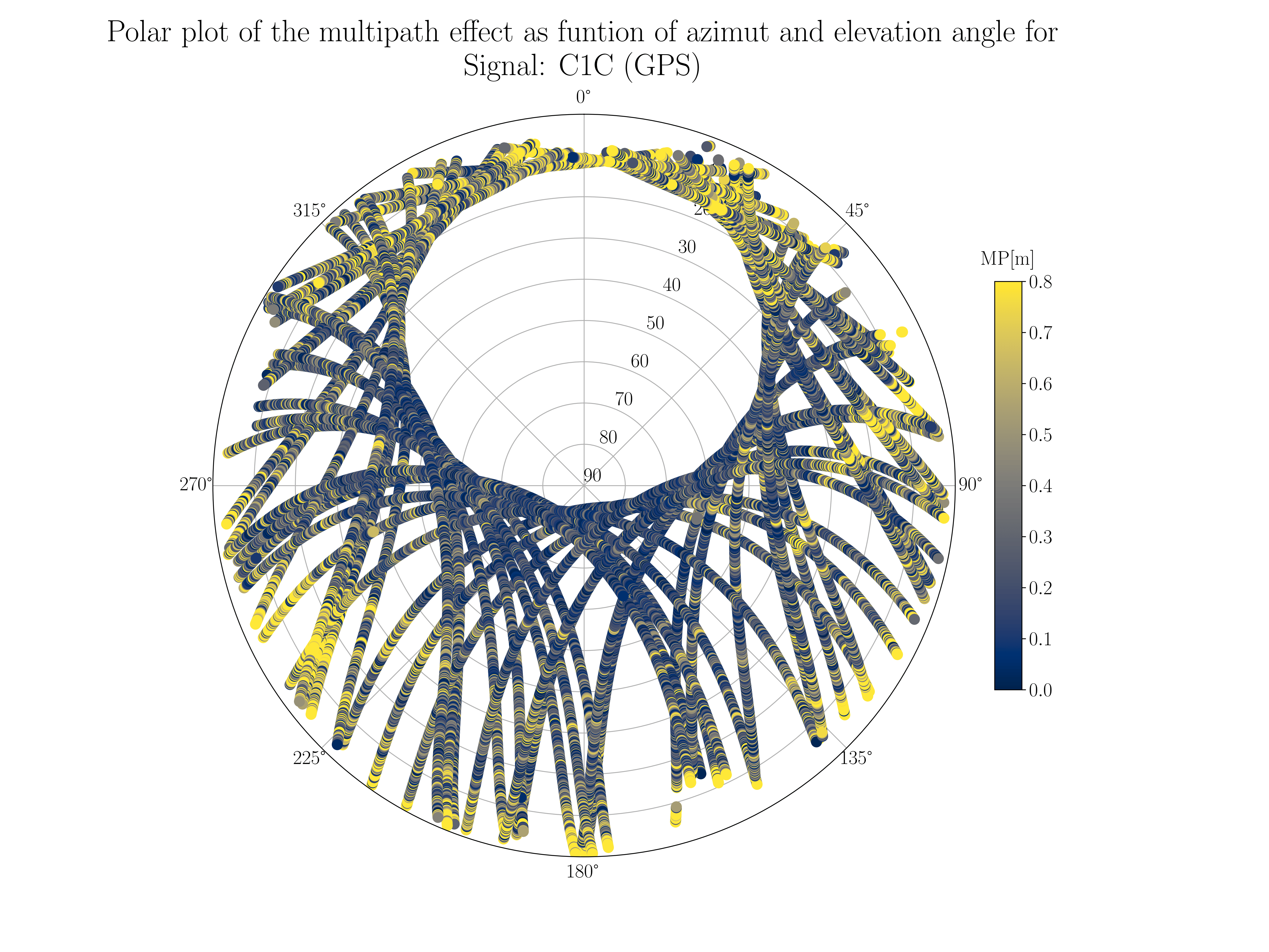
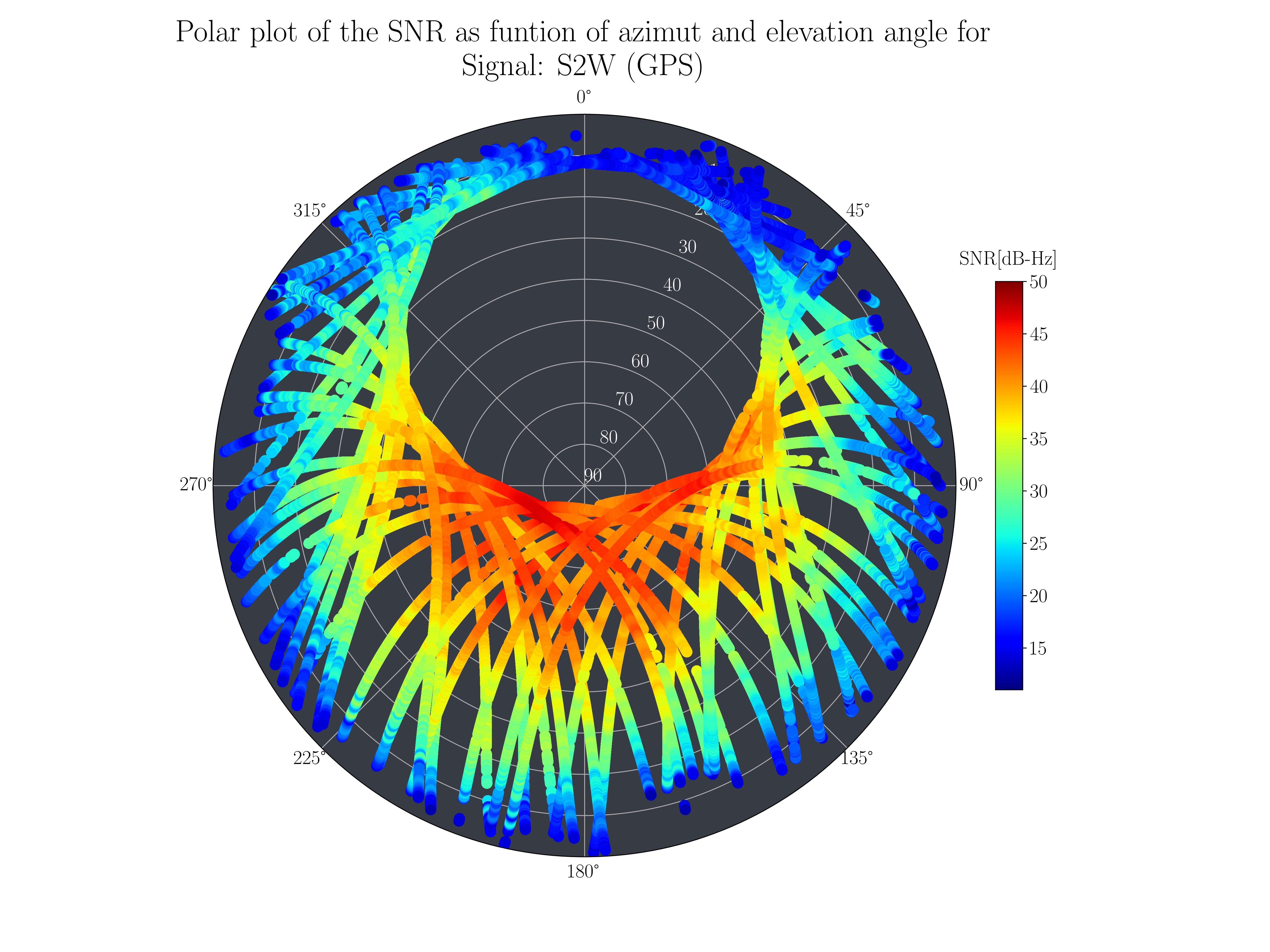

From your description, it sounds like you're looking for a higher-level summary: a binned heatmap that shows the average multipath or SNR per sky sector, to more easily spot persistent reflection zones or signal blockages? That interpretation makes sense, and I’ll look into adding this kind of aggregation option.
Thanks again for the thoughtful suggestion — feedback like this is very helpful!
Yes, all the individual satellite and signal plots are great, but they are overwhelming for my case. What I was proposing was intended to be a single (well, two -- one multipath and one CNo) plot that would let you see what the antenna is seeing as a summary. I know polar plots are more common, but having 0 - 360 degrees of azimuth on the X axis and 0 - 90 degrees of elevation on the Y axis would give you a panoramic view to show obstructions and reflection sources.
Thanks so much for considering this!