maputnik
 maputnik copied to clipboard
OpenLayers projection support
This pull request is the first step towards OpenLayers projection support.
The motivation: I wanted to create a vector map of Antarctica, and couldn't find an easy way to do that. I found a few bit a pieces here and there but the examples I found used 'dirty reprojection' (see https://medium.com/devseed/dirty-reprojectors-1df66e8f308d). Which I wasn't really a fan of because it messes up the lat/lon of the map.
Because OpenLayers has proper projection support (mapbox-gl does not), I thought I have a go at creating some vector tiles in different projections and adding a UI to Maputnik. Here's what I've got so far.
I have a script which generates vector tiles using GDAL from a definition file https://github.com/orangemug/vector-tiles-projection-test/blob/master/definition.json . The definition files specifies a target projection (epsg) with GDAL auto detecting the source projection.
    {
      "id": "antarctic_coastline",
      "name": "",
      "attribution": "",
      "description": "",
      "epsg": "3031",
      "min_zoom": 0,
      "max_zoom": 2,
      "out_dir": "vectortiles/EPSG3031",
      "input_file": "data/EPSG3031/Coastline_medium_res_polygon/Coastline_medium_res_polygon.shp"
    }
I've had to make some small changes to ol-mapbox-style to load the projection from the tilejson https://github.com/openlayers/ol-mapbox-style/compare/master...orangemug:feature/add-projections . I'll raise a ticket in the ol-mapbox-style repo to try and get these merged over the next couple of weeks. I'm sure there will be changes required because I'm pretty new to OpenLayers.
The styles have 2 new keys in the source projection and extent https://github.com/orangemug/vector-tiles-projection-test/blob/2df924154f7f88b59fb7543d47a6b9972ffc601b/styles/epsg3031.json#L9-L15 which are loaded by the modified ol-mapbox-style described above.
There is also some additional UI in the settings panel
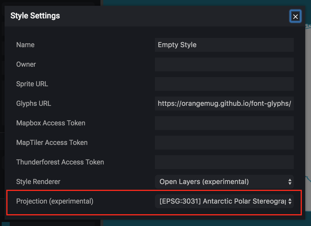
Here's a screenshot of an antarctic map in Maputnik

Also a couple of links to the demos
- https://orangemug.github.io/vector-tiles-projection-test/styles/epsg102003.json
- https://orangemug.github.io/vector-tiles-projection-test/styles/epsg3031.json
So how can you all help
- Look at the demos and tell me if anything isn't working?
- Is the general approach for generating vector tiles sensible? Am I missing anything obvious?
- What do you all think?
Note: This is probably going to be sometime before it's merged, I wanted to get it out there so I can gather feedback and to give me time to try and get the ol-mapbox-style changes upstream. I'm going to switch back over to #521 in the short term to try and improve the performance of Maputnik but this will be moving along slowly in the background.
@orangemug this looks very interesting!
Some questions and thoughts (I'm not familiar with ol projections until now):
-
Is the additional source key
projectionreally needed? The projection is already in the style metadata (could be namedol:projection). If there are multiple sources in a style, the projection must be the same for all sources, right? -
What's the purpose of the source key
extend? ~~Couldbounds(https://docs.mapbox.com/mapbox-gl-js/style-spec/#sources-vector-bounds) used instead?~~ EDIT: Althoughboundsis an array of numbers, depending on the projection the extend might not be inlng/latas defined by the style-spec.
Good questions @pathmapper
OpenLayers can do 'client-side raster reprojection' of tiles https://openlayers.org/en/latest/examples/reprojection-by-code.html. So in that instance you could in theory have a projection on a source that is different to that of the map. This is only available for raster sources currently however
- I thought it was good to keep the API consistent across sources
- I could see this being available for vector sources in the future
It's worth noting that as far as I can see client side reprojection has some drawbacks, so it's not a fix all. So either way most of the time you'd want tiles in the maps intended projection anyway.
Also worth noting, that at the moment the changes for ol-mapbox-style are only for vector sources. It'd be good to have raster also, but that's for later down the road.
The ol:extent is the extent in the coordinate reference system of the projection. Using lat/lon gets messy with polar projections. Trying to type this reasoning I'm having problems putting it into words, but basically the south pole is {lat: -90, lon: ??}, where lon can be anything from -180 - 180, things just seems to get complex really quickly.
I'm pretty novice on all this also, so if anything sounds incorrect it might well be.