Two questions about the paper
Hello, I'm reading your paper MAPNET and have two questions, hoping to get help from you
-
While doing ground projection
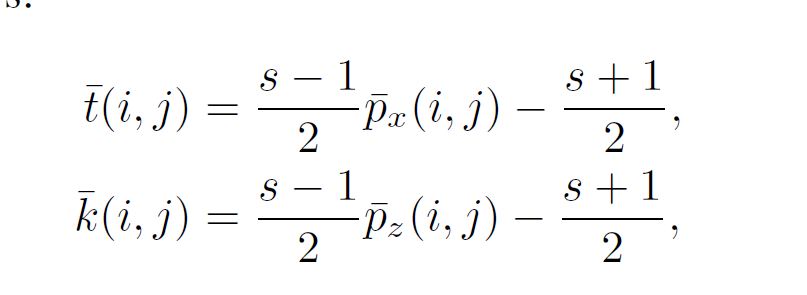 this really doesn't make sense, what's the range of px and py?You doesn't even take into consideration the actual length of each bin per grid in the SxS grid. That cause weird coordinate range in the SxS grid. Instead the implementation in your code make sense

-
Another question is about the training procedure, your description in the paper is really unclear. Did you mean that building map and doing localization in the same time ? per step in the sequence you doing localization first and update the map even if it is a wrong localization ?But how can you doing accurate localization since you are first time in that place? I thought there should be a phase of building a map based on a sequence first , then collect another sequence for localization to calculate loss .But I couldn't find it in the paper.
Hoping to get help from you, thanks!