turf
 turf copied to clipboard
Unexpected scale behavior for large areas that intersect WGS84 boundaries
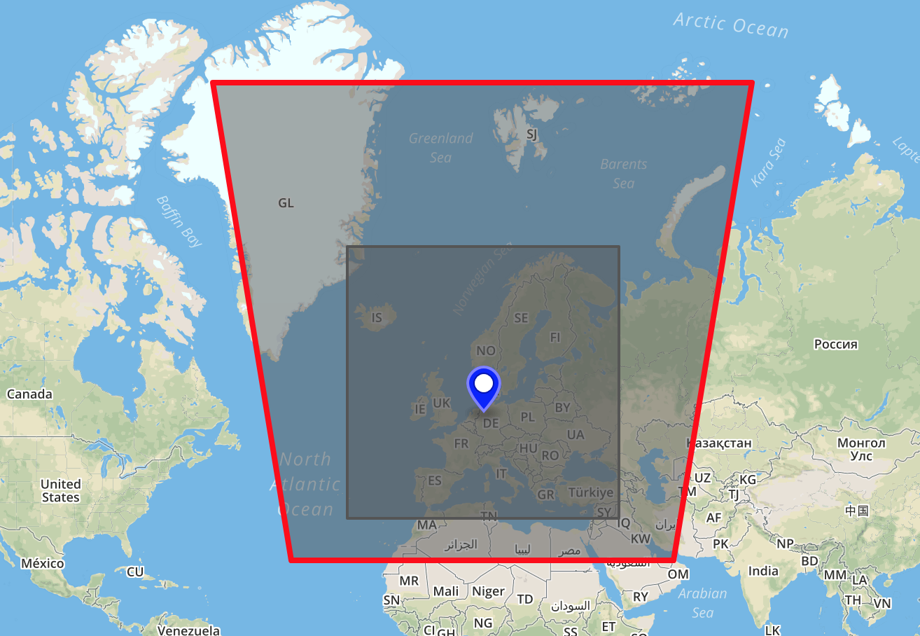
I tried to double the bounding box of Europe using turf and I get this weird result:
- Gist: https://gist.github.com/anonymous/5c524c6f302d07ba32674f7b7f2420d0
- Code to reproduce:
const Europe = /* See GeoJSON */;
const doubleEurope = transformScale(Europe,2);
const boundsOfDoubleEurope = bboxPolygon(bbox(transformScale(Europe, 2)));
The gist is quite self-explanatory.
The wrong result of transformScale clearly affects everything else. What I don't get is why it warps the resulting rectangle, extending its northern side much more than twice (or perhaps it is just inverting some sign).
Other similar odd results:
- using a different center (e.g. 'ne', 'sw') results in other wrong figures
- using scale factors higher than 2 results in even stranger figures.
I would expect the scaled figured to be clipped with WGS84 properly, and to never warp.
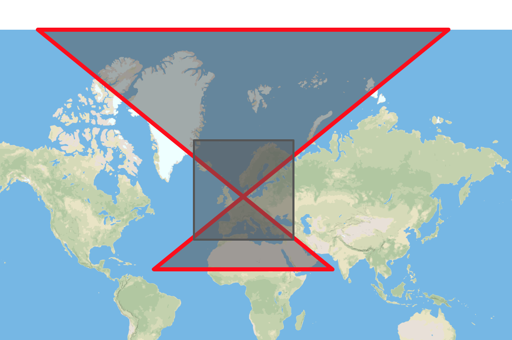
I was just looking at this and I believe it's mainly due to the WGS84 projection. Also in this case, like for grids, we should probably work with Mercator. Why it's inverting the vertices I don't know right now.
I guess we could have an optional projection='wgs84'|'meractor' parameter allowing the user to decide (mainly in the borderline cases) or decide to automatically switch to Mercator above a certain dimension/extension of the input, like I did here to correct the expected output.
👍 @stebogit Yep definitely a projection issue, we can default to Mercator and have an option to preserve the transformation in WGS84.
We tackle this issue for Turf v5.1+