gpdvega
 gpdvega copied to clipboard
Published
20 hours ago •
 iliatimofeev
gpdvega is a bridge between GeoPandas and Altair that allows to seamlessly chart geospatial data
gpdvega 


gpdvega is a bridge between GeoPandas a geospatial extension of Pandas and the declarative statistical visualization library Altair, which allows to seamlessly chart geospatial data using altair.
Example
import altair as alt
import geopandas as gpd
import gpdvega
alt.renderers.enable('notebook') # render for Jupyter Notebook
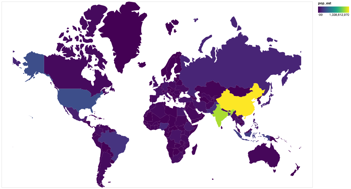
world = gpd.read_file(gpd.datasets.get_path('naturalearth_lowres'))
# GeoDataFrame could be passed as usual pd.DataFrame
alt.Chart(world[world.continent!='Antarctica']).mark_geoshape(
).project(
).encode(
color='pop_est', # shorthand infer types as for regular pd.DataFrame
tooltip='id:Q' # GeoDataFrame.index is accessible as id
).properties(
width=500,
height=300
)
Install
Dependencies
gpdvega requires:
- Altair (>= 2.2.0 )
- GeoPandas (>= 0.4.0)
User installation
using pip
pip install gpdvega
Changelog
See the changelog for a history of notable changes to gpdvega
Metadata
52
Stars
5
Forks
Watchers
Owner
Metadata
gpdvega is a bridge between GeoPandas and Altair that allows to seamlessly chart geospatial data