Neel Mehta
![]()
Neel Mehta
#104 mentioned this a while ago, but it's outdated. The newer way to phrase this feature request is: on our Marey Charts ([example](https://muni.opentransit.city/route/44)), can we give users the option to...

I'm not sure how far we got with our old project to scrape Muni schedule data, but we should finish it. This is essential to enabling stuff like on-time performance...
...and then we'll geocode it and show you which routes you could take / which stops you're near. Kind of like: 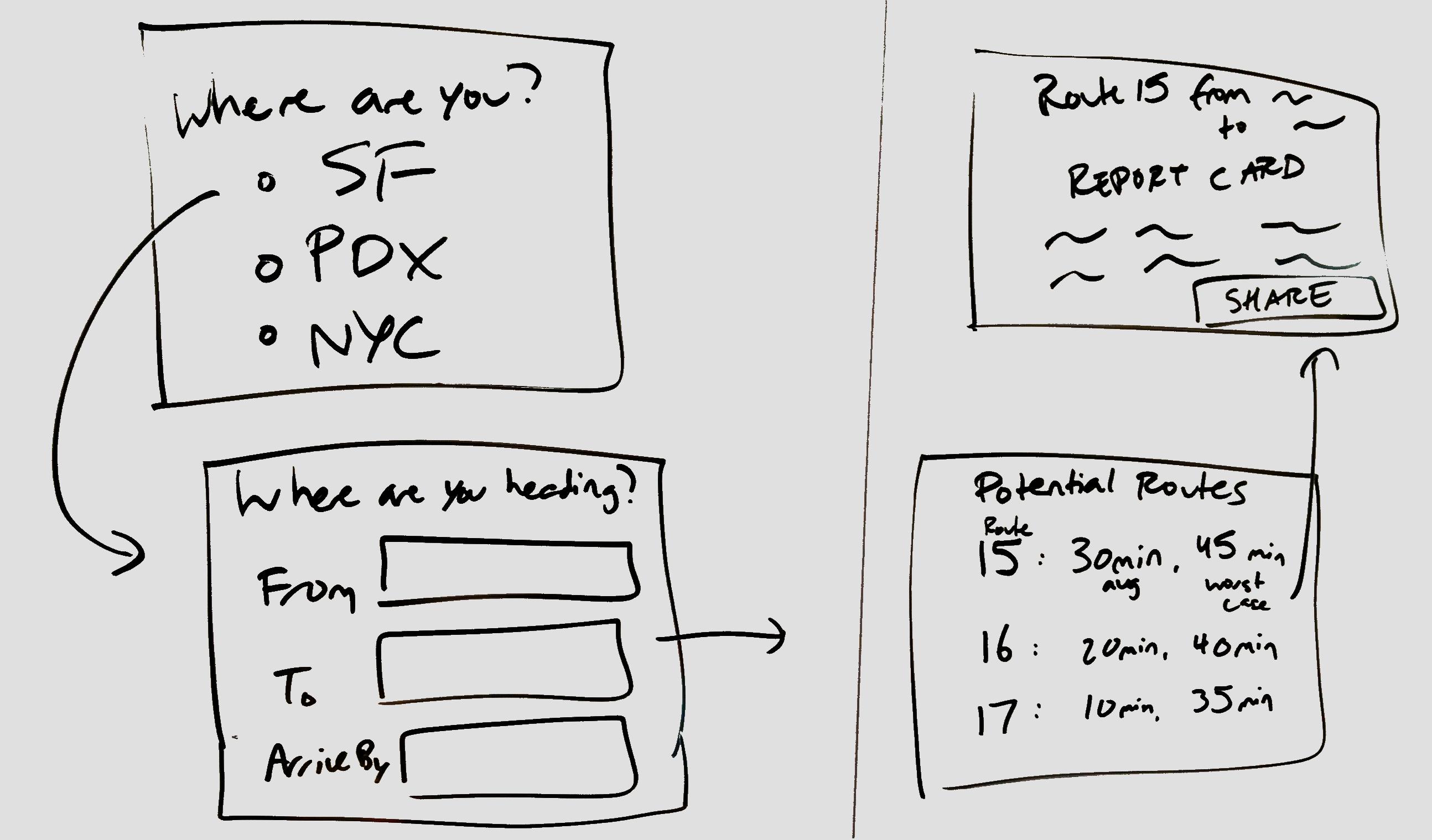
SF is considering adding BRT lanes to various routes. Can we simulate the effect it would have on each route (and the knock-on effects it would have on the rest...
SFTR and others have been interested in overlaying Muni's total footprint with other cities' to see how much better or worse Muni is than comparable systems. Can we let users...
A startup called Interline has just published a list of GTFS feeds for all the Bay Area transit systems: https://www.interline.io/blog/mtc-regional-gtfs-feed-release/. We should pull from their API to start integrating data...
Or perhaps elsewhere in the UI. This will help as we scale up. I'm not sure if the TriMet data is current visible or if it just resides in someone's...
See the "2 - Sutter/Clement" -- without the padding on the cell, it looks crammed. 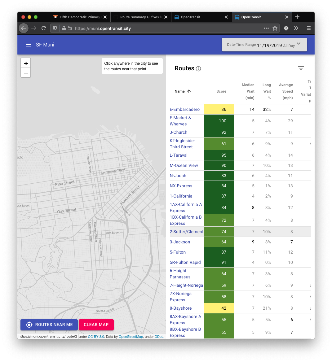
The map on the homescreen is currently restrained to a certain max zoom distance (good). But once we start supporting multiple transit agencies, it'd be really cool to remove that...
@exxonvaldez and I had this conversation based on #300. What if we let users import some external dataset (say, Census data) as a GeoJSON and overlay it on our map?