geofacet

geofacet copied to clipboard
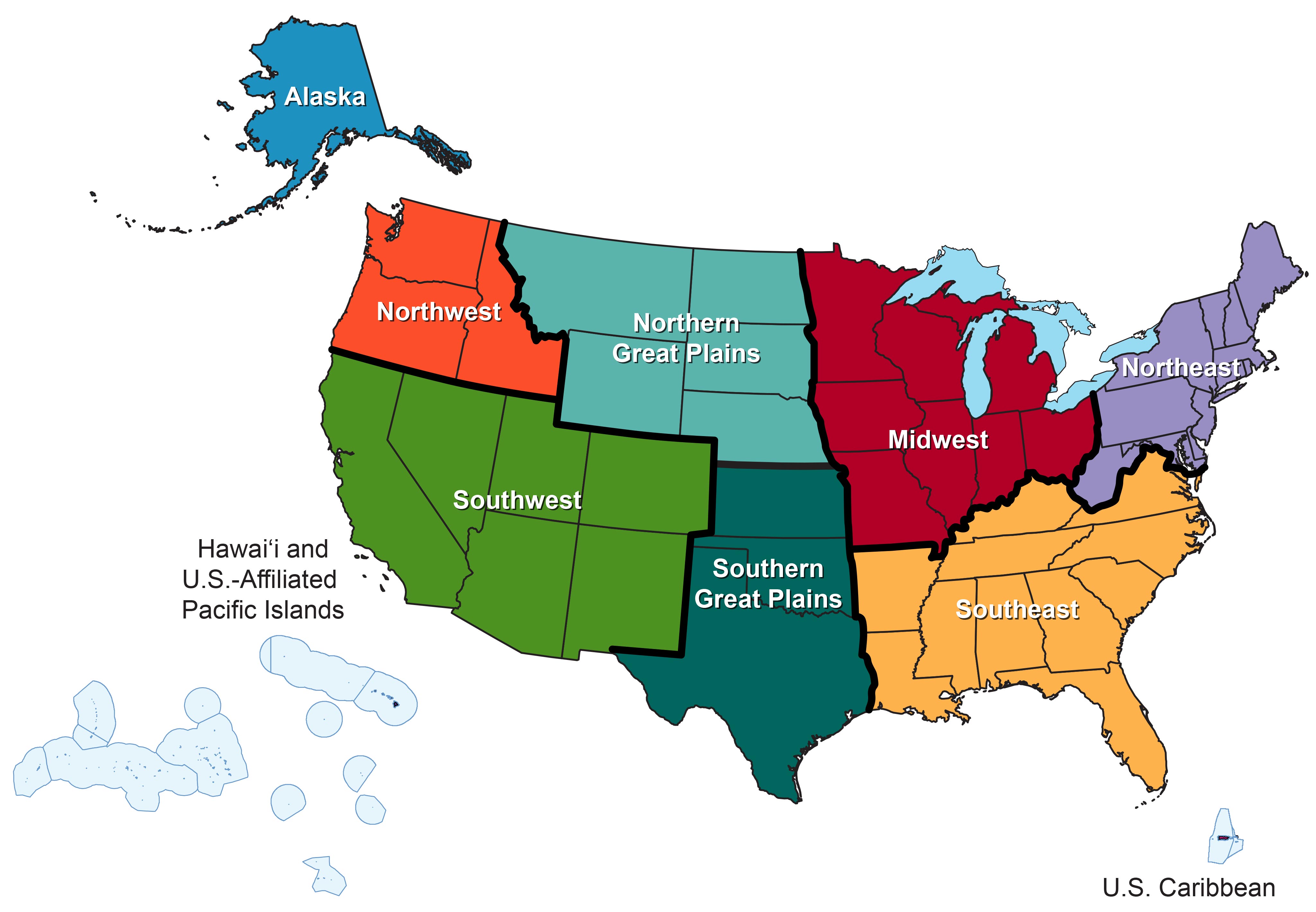
4th US National Climate Assessment Grid
[[Note: Please edit the title above and provide a description of the grid here. Also check the ISO_3166-2 (https://en.wikipedia.org/wiki/ISO_3166-2) codes if your grid uses countries or states/provinces. Finally, if you can provide an example of your grid in action with a data set and sample code, that would be great but is not required. Remove this text before submitting.]]
Grid data:
row,col,code,name
1,1,AK,Alaska
2,2,NW,Northwest
2,3,NGP,Northern Great Plains
2,4,MW,Midwest
2,5,NE,Northeast
3,1,HI,Hawaii and US-affiliated Pacific Islands
3,2,SW,Southwest
3,3,SGP,Southern Great Plains
3,4,SE,Southeast