FloppsMap
 FloppsMap copied to clipboard
Online map with draggable markers, waypoint projection, geocaches, ...


![]()
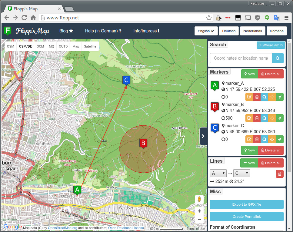
Flopp's Map
Flopp's Map is an online map service, based on the Google Maps API and OpenStreetMap, which provides functionalities especially interesting for geocachers:
- Several map styles (satellite, various OSM styles, hill shading)
- Search by coordinates and location names
- Draggable markers for determining coordinates, distances, bearings (angles)
- Waypoint projection
- Display of geocaches from the Opencaching network (via OKAPI)
- Display of German nature protection areas
- Permalinking to the current map
- Translated to English, German, Dutch, Polish, Romanian
Visit the map at https://flopp.net/
Third Party
Flopp's Map includes the following open source, third party components:
Flopp's Map uses the following third party components/services:
- Google Maps JavaScript API
- Bootstrap - via Cloudflare's CDNJS
- jQuery - via Cloudflare's CDNJS
- JS Cookie - via Cloudflare's CDNJS
- i18next - via Cloudflare's CDNJS
- JS Translation of GeographicLib
- Font Awesome - via Cloudflare's CDNJS
- OSM map tiles by http://openstreetmap.org/, http://openstreetmap.de/
- Geocache data via http://opencaching.de, http://opencaching.pl, http://opencaching.nl, https://opencache.uk, http://opencaching.us, http://opencaching.ro
- German Nature Protection Area data provided by http://www.bfn.de/
Authors/Contributors
- Florian Pigorsch [email protected]
- Harrie Klomp: Dutch translation
- andrixnet: Romanian translation
- mzylowski: Polish translation
- FriedrichFroebel: Various fixes
- vsandre: Tile provider update
License
Flopp's Map is governed by a MIT-style license that can be found in the LICENSE file.