RAiDER
 RAiDER copied to clipboard
Benchmark comparison with thrid-party
GACOS comparison over CA with RAiDER HRES model to investigate if there are obvious implementation differences. Recommend the comparison of Zenith absolute delays, would need to confirm with GACOS what the maximum interpolation height is used in their computations.
Take 1by 1 degree tiles:
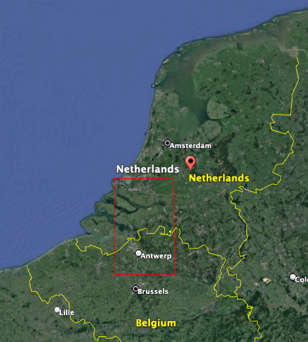
- Europe (Holland flat, wet)
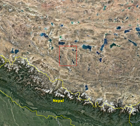
- Tibet (steep and large terrain, dry)
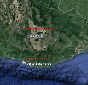
- Southern Mexico (Coast, tropical)
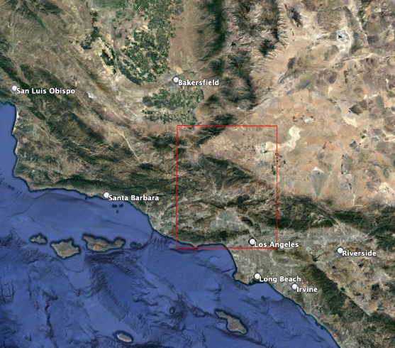
- Southern CA (terrain, dry)
Procedure
- Go and figure out the dates to be request.
- use the dates, 6 UTC, and 1 degree bbox to trigger gacos using tiff option
- use gacos tiff to define Raider AOI
- trigger raider for the dates, 6 utc, model levels, and using the raider AOI, ECMWF HRES
** comparison**
- compare full raster:
- mean biass of the stack of images (indicates something about the integration height )
- mean std of the stack of images (interpolation)
- visual inspection of images
- compare original ECMWF weather model grid nodes This would exclude spatial interpolation artifacts.
I am waiting on GACOS data, but to summarize I've requested data for the 1st of each month of 2019 (e.g. 2019-01-01, 2019-02-01, etc...) across the following defined 1x1 degree AOIs:
-
Netherlands (S/N/W/E = 51/52/4/5)
-
Southern Tibet (S/N/W/E = 30/31/84/85)
-
Southern Mexico (S/N/W/E = 16/17/-97/-96)
-
Southern CA (S/N/W/E = 34/35/-119/-118)
I will coordinate move/work on leffe once I get the data.