Arda
 Arda copied to clipboard
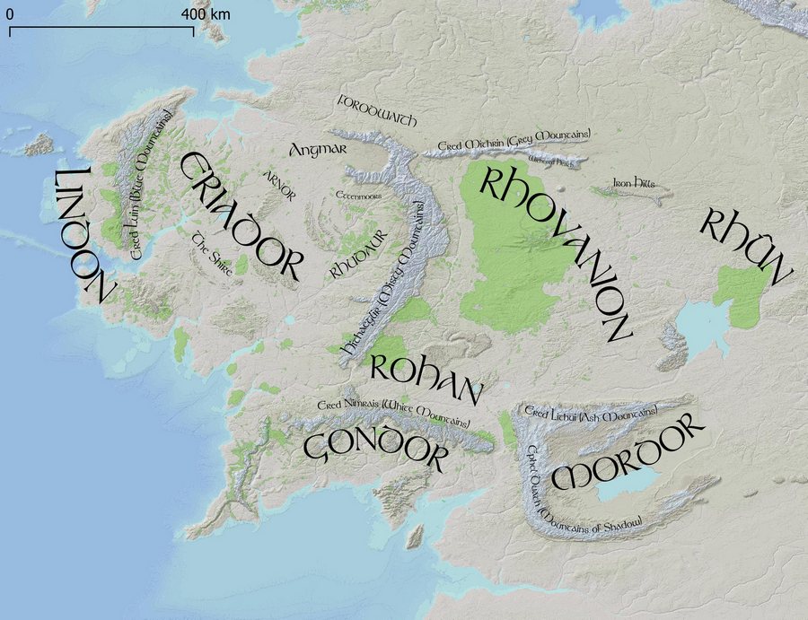
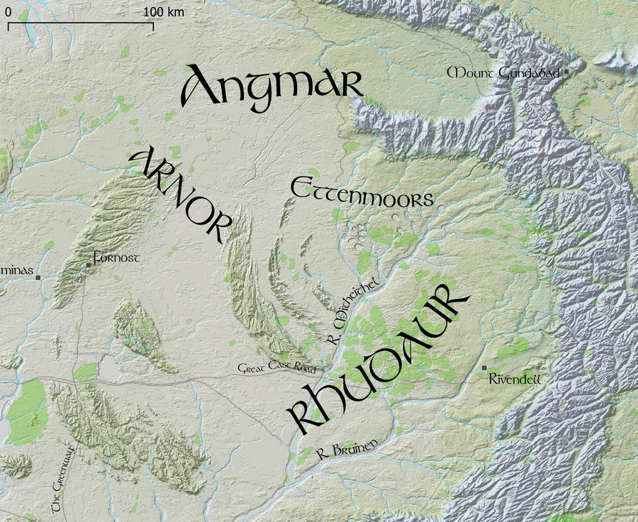
Maps of J. R. R. Tolkien's Middle Earth using DEM (Digital Elevation Model) and place vectors
Arda
Maps of J. R. R. Tolkien's Middle Earth, using a DEM (Digital Elevation Model) and place name vectors.
Arda was the name of the entire world, which included the part known as Middle Earth.
Goals
- Make colored elevation maps with hillshading
- Make name placement and size similar to Tolkien's maps
- Use as detailed maps for Adventures in Middle Earth (D&D 5e) games
Data
The DEM is stored in a 10k x 10k jpg file, made by monks and Redrobes on the Outerra Worlds Forum. The process apparently included some real-world 3d elevation data, hand-editing, and simulated erosion. Somewhere they also have a 40k x 40k DEM (50m/px) version.
The vector data includes place names, rivers, forests, mountains - made by monks, SeerBlue, and Redrobes, and maintained by jvangeld here - https://github.com/jvangeld/ME-GIS. I added the curved Tolkienesque labels and colored the different elevations.
The entire map covers 2000km on each axis, so the resolution of the DEM is 200m/px.
The file data/rasters/10K.wld defines how the DEM corresponds to the map coordinate system as used by the vector data. This is currently slightly off - improvements could be made.
Installing
Clone this repo
git clone https://github.com/bburns/arda.git
cd arda
Clone ME-GIS to the data/vectors subdirectory
git clone https://github.com/jvangeld/ME-GIS data/vectors
Get the Tolkien font here - https://fontzone.net/font-details/tolkien
Install QGIS
Open arda.qgs in QGIS
Build the hillshade layer - Raster / Analysis / Hillshade - enter a z-factor of 100.0 and click Run. Then adjust the global opacity of the layer to 50% - Layer Styling sidebar / Transparency / Global Opacity. This builds a ~100MB TIFF file in a temp folder so is not included in the repo.
Todo
- Add river sizes in meters and render widths accordingly
- Make map views for the Hobbit (overview, The Shire, Eriador, Misty Mountains, Mirkwood)
- Make map views for The Lord of the Rings corresponding to travels
- Explain QGIS and pull requests for shapefile data in readme
- Switch easily between colorful and minimal color versions - how do?
- Get access to 40k x 40k DEM (50m/px) version
- Render to tiles for Google Maps-like site, using Leaflet - try vector map tiles and mapboxGL? include search index
License
My contribution (labels and coloring) is MIT. The 3d DEM data/jpg is more uncertain - you'd need to find monks and Redrobes to know for sure.