Brian Sperlongano
Brian Sperlongano
Just removed another handful of indexes from the list that aren't actually made in the SQL layer.
In principle, this change is fine, but `ref` + `unsigned=yes` is an obscure combination that, according to taginfo, only occurs in 189 (now 188) cases. The more typical method of...
> For example, replacing `ref=*` with `unsigned_ref=*` on the route relation is problematic if the `ref=*` is actually important for identifying the unsigned route (e.g. unsigned E-roads). It e.g. breaks...
> Instead of having a couple of classes, OMT currently has 200+ different "class" values.. and that defeats the purpose of class/subclass. I also don't think it's a good idea...
Note that traffic signals are currently rendered on osm-carto, so it would be appropriate for OpenMapTiles to support this also. [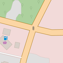](https://www.openstreetmap.org/relation/7426074#map=18/41.56566/-71.46354)
Adding ne_10m_urban areas will certainly be an improvement, and I've already proposed that change in my PR at openmaptiles/openmaptiles-tools#424. In the US, residential landuse is a poor proxy for urban...
A large number of `waterway=dam` _nodes_ are the result of a mass import of GNIS data in the US, so we may not want to encourage dam nodes.
By rights, each boundary line should have all of it's left/right areas encoded, at all admin levels, or at the very least the most important one. I've thought about how...
Very very hacky, and I envisioned the same approach but I couldn't figure out how to determine the winding in pure Imposm+SQL
> Maplibre doesn't support some scripts (e.g. Burmese, Lao, and other Brahmic scripts), so it can't display the local name. That's not _exactly_ accurate. The issue is that MapLibre doesn't...