Partial marker segments don't line up correctly when rendered on a map
Hi! Thanks for maintaining this library. I'm writing to report a bug or quirk when using protobuf tiles with a custom marker icon that has an iconAnchor set to make the bottom center point of the marker anchor to the lat/lng location.
Specifically: it appears that the markers on the edges of tiles aren't lining up correctly and are therefore not forming correct parts of a whole. For example, here's a set of protobuf tiles with points in the U.S.:
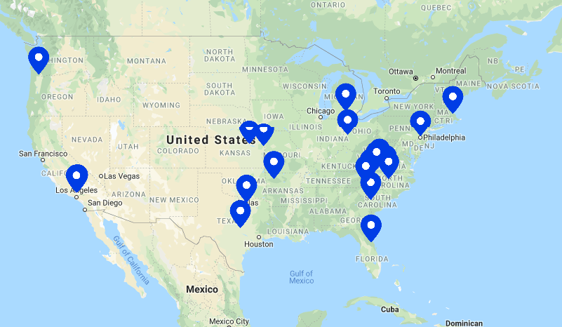
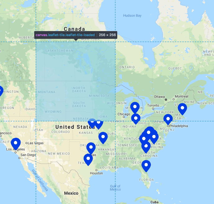
If you look at the two points around Nebraska/Iowa, you can see that they're fused incorrectly such that it doesn't make up a whole marker.
Here's are the tile boundaries:

Do you have any ideas how to fix this? I've noticed that there's a buffer option to pass to the slicer class, but no similar option for protobuf. We're generating our own tiles from PostGIS and have already tried out expanding the buffers there, but this seems to be a problem of rendering the data and not ensuring that it's available in the adjacent tile.
Thanks again for maintaining this library!