postgis-layer-viewer
 postgis-layer-viewer copied to clipboard
A PostGIS layer viewer for pgAdmin3 based on PyQt4 and PyQGIS libs.
PostGIS Layer Viewer
A PostGIS layer viewer for pgAdmin3, based on PyQt4 and PyQGIS libs.
License: GNU/GPL v.2.0
Current version: 1.6.1 (2015.02.24)
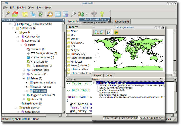
With this pgAdmin3 plugin you can:
-
View PostGIS layers. It supports both vector and raster layers.
-
Get layer metadata such as connection string, vector/raster type, SRS, Extent, Width-Height in pixels (for rasters), number of bands (for rasters), number of features (for vectors), number of fields (for vectors).
-
Run and visualize PostGIS queries.
Installation and usage instructions at GeoTux.
Screenshots
pgAdmin's GUI
Raster support

Run and visualize your PostGIS queries

See the changelog at https://github.com/gacarrillor/postgis-layer-viewer/blob/master/postgis_viewer/changelog.txt
Metadata
Owner
Metadata
A PostGIS layer viewer for pgAdmin3 based on PyQt4 and PyQGIS libs.