metacatui
 metacatui copied to clipboard
Export publication ready maps from cesium
Add a button so users can download the current Cesium view as a .png image.
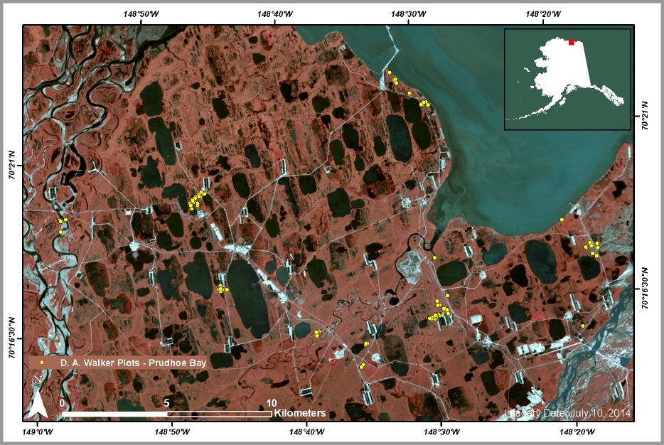
The image should ideally be publication-ready, and include elements like: a legend, scalebar, and coordinates, for example:
A complete publication ready map should include the following:
- compass view *
- scale bar view *
- ability to switch to a 2D view
- complete legend view (https://github.com/NCEAS/metacatui/issues/1784)
- ability to export citations of currently visible layers
- potentially: a mini-map indicating the region of the world where the main map is located
* the compass view and the scale bar view will be challenging if the exported map is to be displayed in 3D (e.g. tilted at an angle)
The first task should be to determine what the MVP version of this feature will be, then decide how to iteratively release more features
This would preferably also include a doi being generated so anyone can re-create the figure and so its clear what data was used to inform the figure. The feature would serve 1) scientists in generating publication-ready figures for peer-review manuscripts and 2) for community members as they write reports or proposals for assessment and/or planning purposes.
For a DOI, we could do that in a couple of ways: 1) export the image into the ADC archive so it is preserved and issue a DOI for it, with appropriate links back to the original dataset, or 2) link back to the PDG portal to show the same view that created the link (as described in the "My Maps" ticket #1806) and have the DOI redirect to that. The latter only really works if our PDG layers and portal are archival (e.g., we expect PDG to be maintained for decades). We could do both, and maybe others.
Thanks Matt! My goal is to establish more data transparency, access, and reproducibility for the science community in general, but for big geospatial data more specifically. So whatever we decide to implement with a doi, we also need to ensure that it meets the long-term vision of the ADC.